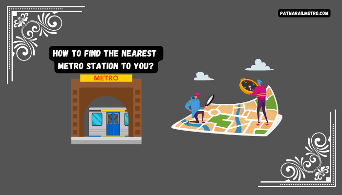
Urbanization and traffic congestion has caused more and more people to turn to public transportation as their primary form of transport. In India, the metro system is one of the most reliable and affordable modes of transportation. Its expansive network ensures that a metro station will always be nearby no matter where you are in India.
So, the question is – how do you find out which metro station is closest to you? Fortunately, there are a few different ways to find this information. In this blog, we will discuss how you can locate the nearest metro station in India.
1. Check The Official Metro Website:
The metro system of your city can be easily accessed via its official website. On this site, you can find the station map that shows the locations and lines of each station. By entering your current location or postcode, you can instantly determine which station is closest to you. In addition to this information, the website also provides useful data on metro lines, schedules, and fares, helping you plan your journey. For anyone looking to find the nearest metro station with the help of the website, here are the simple steps to follow:
- Step 1: Open the metro website on your computer or phone.
- Step 2: On the top of the page, click on the “Network Map” tab.
- Step 3: This will open up a map that displays all the metro lines and stations in your area. Click on the desired line.
- Step 4: This will zoom in on the line, and you can then click on each station to find out more information, such as its location, the distance from you, and available facilities.
2. Use Google Maps:
Finding the nearest metro station to you has never been easier than with Google Maps. Google Maps is an online mapping service that allows users to view maps, directions, and traffic information easily. Using Google Maps to find the nearest metro station to you requires just four easy steps:
- Step 1: Start by opening Google Maps on your smartphone or computer.
- Step 2: Type in your current location or enable location services on your phone to detect your current location automatically.
- Step 3: With your current location on the map, search for “Metro Station” in the search bar.
- Step 4: The map will show all the metro stations nearest to you. By clicking on each station, you can view its location, distance from your current location, and directions to reach the station.
Now you can easily locate the nearest metro station with Google Maps and find your way there quickly and efficiently.
3. Use The Metro Mobile Apps:
Discovering the nearest metro station to your location is simple and efficient, thanks to the metro mobile app. Available for both Android and iOS, the app can be downloaded for free from the respective app stores. To use the metro mobile app to find the nearest station to your current location,
- Step 1: Begin by downloading and installing the app.
- Step 2: Then, open the app and click on the “Nearby Stations” tab. Once you’ve done that, the app will use your phone’s location services to identify and display all metro stations nearby.
- Step 3: Finally, you can select a station from the list. You’ll be able to see its location, distance from you, and available facilities.
You’ll know exactly which station is closest to you with just a few clicks.
4. Ask A Local:
When in an unfamiliar city, you may not always have the most convenient access to the internet or a smartphone. Don’t fret, however, for there are always people on hand that can point you in the right direction. Locals can provide the best advice when navigating an unfamiliar city. With detailed information about nearby places, such as the nearest metro station, you can ensure that you are never left without a way to get to where you need to go.
Finding a local can be as easy as approaching a nearby shopkeeper, a security guard, or even a passing stranger. Each person has likely had much experience navigating the area, so you will get the necessary information. With some locals’ help, finding your way around a new city is simple.
5. Use Social Media:
Social media is valuable for anyone looking for their nearest metro station. For example, many Facebook groups and Twitter handles provide crucial information about metro systems worldwide. All you need to do is search for the respective group or handle, then post a request for assistance with the closest metro station to your location.
Alternatively, one can utilize Twitter hashtags related to metro networks for real-time updates about transportation systems. Moreover, asking questions through the hashtag might result in speedy answers from other users.
Ultimately, using social media can be an efficient way to discover the nearest metro station quickly.
6. Check Metro Signs:
When visiting a bustling destination such as a shopping district or tourist attraction, navigating the local area can often be difficult. However, if you keep your eyes peeled, you should notice signs marked “metro” close to the entrances of metro stations. These signs provide important information about the station, such as its name and the metro lines running through it.
The metro signs are there to guide you, allowing you to identify the nearest station to your current location. If you have trouble locating a sign, asking for directions from nearby security guards or police officers should point you in the right direction.
Frequently Asked Questions:
A: You can find the nearest metro station to your location by using various methods such as:
Using the official metro app of your city: Most metro cities have their official metro apps that provide information on the nearest metro station to your location.
Using Google Maps: Google Maps also shows the location of nearby metro stations and provides directions on how to reach them.
Asking locals: You can ask locals in the area or at nearby shops for directions to the nearest metro station.
A: It is possible to find the nearest metro station to you using your smartphone’s GPS. By enabling location services on your smartphone, you can use various apps like Google Maps, Citymapper, or Transit to find the nearest metro station. These apps use your GPS coordinates to locate nearby metro stations and provide you with real-time information on the metro schedule, fares, and directions on how to reach the station.
Conclusion:
Finding the metro station nearest to you can be straightforward, especially with today’s technology. The official metro website, Google Maps, mobile apps, and checking the metro signs can all provide information that can simplify the process.
When you successfully discover the closest station, the benefits of public transportation become apparent. Taking the metro can help save both time and money, allowing you to make the most of your travel. Moreover, the convenience that public transportation offers cannot be overstated.
However, if you still have difficulty, don’t hesitate to ask a local for directions. They can provide useful advice that may take you directly to the station, allowing you to enjoy all the advantages of public transport without worrying about a long, tedious search.